
We provide the ultimate oversight tool for private and public land managers. Built tough for Australia.
-
Precisely know the plants on your land
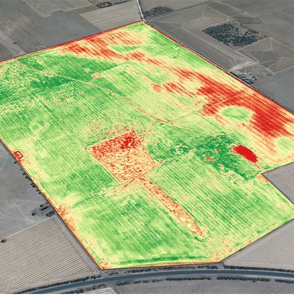
Learn exactly what you need about the plants and your land. We can tell you precisely what your plants are, exactly where they are, their health concerns, carbon inventory and how to manage them better. Including accurately locating and identifying invasive weeds. We can catch other growth stressors earlier, from water issues and disease to insect attacks. More efficiently helping you grow the things you want with less of those you don’t.
We help you increase yields whilst reducing inputs including labour, water, pesticide, herbicide and fertiliser use.
-
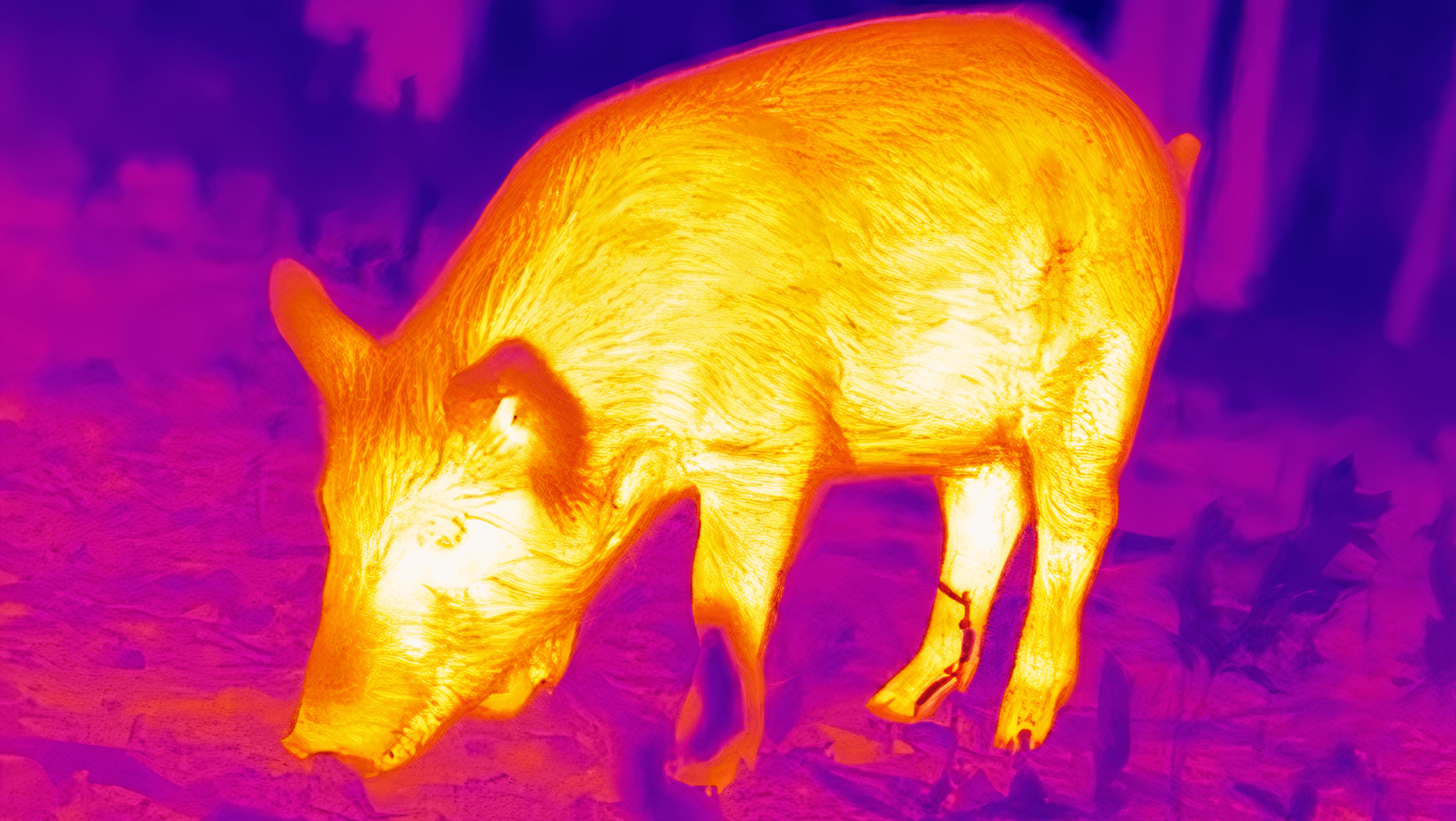
Precisely know the animals on your land
Learn exactly what you need about the animals on your land. We can tell you what they are, where they are and how to manage them better. We can help identify and locate invasive vertebrate pests for easy targetted management, whilst helping you better look after wildlife and livestock.
We help you increase productivity, personal safety, sustainability and animal welfare whilst reducing labour, machinery usage and other expensive resources.
Intro

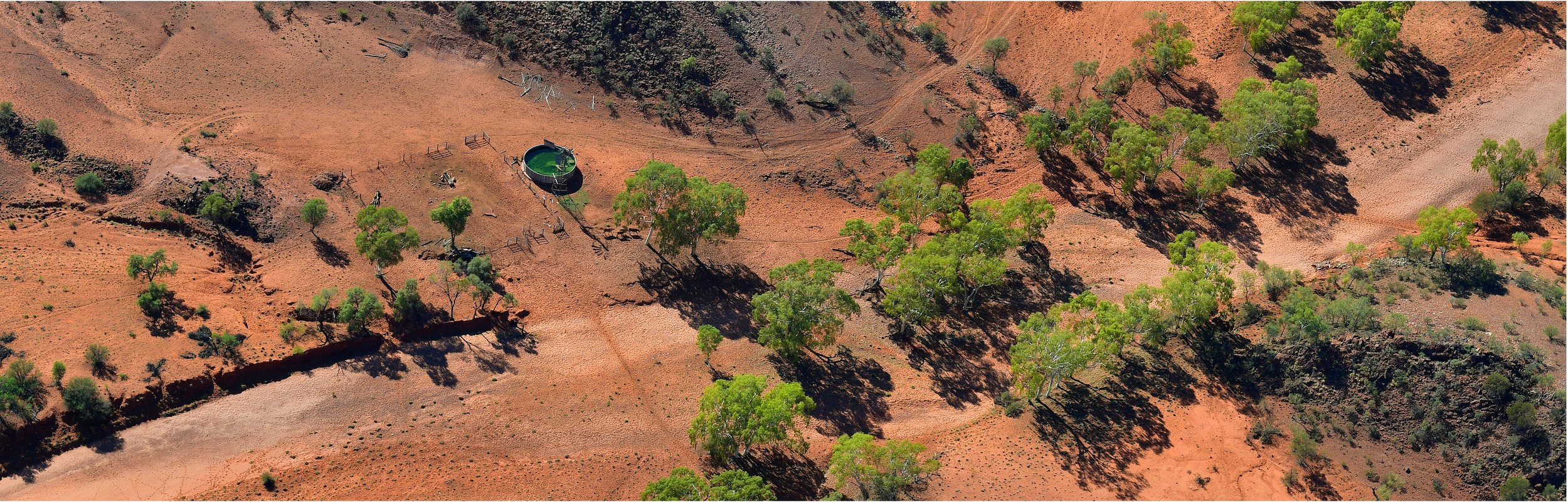
Solving Australia’s invasive flora and fauna problem
CSIRO and Flinders University report that introduced flora and fauna pests are costing Australia over $25 billion each year. That’s over 1% of our GDP. Over a billion native birds and small mammals are lost to feral cats alone each year. Covid has reinforced the playbook on how to control outbreaks. It has shown that consistent accurate large-scale surveillance survey needs to be a foundational pillar of the management response. This has been the missing element to date. We use world-leading imaging sensors (hyperspectral, thermal and optical) coupled with advanced machine learning to rapidly and accurately locate and identify invasive plant and animal pests across your land.
Most land managers see the benefits drones can bring but don’t want the capital cost and complexity of flying them let alone interpreting the data. We fix that.
770 million hectares. That’s the size of the massive Australian landmass. About 50% is public and 50% is privately managed, including 130,000 farms. Operating as a shared community infrastructure service each of our SpottrHub base stations can service a 200km+ radius area (12.5 million hectares) with best-in-class hyperspectral, thermal and optical imaging that is far superior to the resolution satellite and much lower cost than general aviation. Coupled with deep tech automation and machine learning AI the solution is easy to use. With just 60 Spottr drone+hub units we can provide coverage for 100% of Australia’s land. In doing so we increase our asset utilisation allowing a reduction in the cost of service to you, and bring game-changing sensors to your service that would otherwise be unaffordable and out of reach. We summarise the data to make it user-friendly for you, but you can always access the raw version for integration with your other land management tools.

Advanced drone-tech as regional community shared infrastructure
Spottr is alumni of the Taronga Conservation Society HATCH Accelerator Program. This program refined our solution concept and optimised the proposed business model. It included training, mentorship and an extensive stakeholder consultation process.
The stakeholder consultation process included farmers, animal welfare advocates, hunters, government including Chief Veterinary Officers, NGOs, indigenous stakeholders, scientists, universities and the public. We were particularly interested to use the opportunity to explore community acceptance issues and what safeguards need to be in-built, particularly as related to managing invasive vertebrates.

Collaboratively designed for all stakeholders
Join Our Wait List
We aren’t quite yet ready to sell.
If you are a farmer or public land manager based in Australia and interested in how Spottr could help your organisation please fill in this form.